A couple of weeks ago, the reinsurance company Swiss Re released its annual list of the cities it considers to be the most at risk from natural hazards. This report always makes for interesting reading, and the overall rankings which consider all 5 evaluated hazards have been helpfully covered by the Guardian and others. In this post I wanted to ‘zoom in’ a little to look specifically at the earthquake rankings.
How is it calculated?
Swiss Re takes 616 large metropolitan areas with a combined population of almost 1 billion, and assesses their risk exposure to storms, storm surges, earthquakes, tsunamis, and river flooding. Two indicators are considered: the number of people potentially affected by one or more risks in a given area, and the economic effects of these events based on the value of working days lost. A number of assumptions are followed regarding the proportion of a metropolitan area likely to be affected by different hazards, for example, a storm is more likely to affect a whole city than a river flood. For economic losses, the value of the predicted losses relative to the individual country’s economy is calculated, as well as a global index.
Earthquake hazards
Earthquakes potentially affect 283 million urban dwellers as defined by the study. The most earthquake-exposed city is the Tokyo-Yokohama metropolitan area, followed by Jakarta, Manila, Los Angeles and Osaka-Kobe. The report concludes that ‘while the danger faced by American and Japanese cities is well known, the loss potential from earthquakes in Central Asia and the Northern Anatolian Fault in the Middle East is significant and often overlooked’. This is an important point as Central Asia in particular is a region where the specific form of seismogenic faulting is often less clear than at major plate boundaries, and where intraplate faulting can pose a significant and unpredictable hazard.
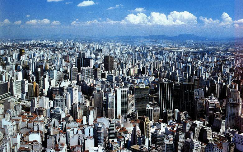
The Tokyo-Yokohama metropolitan area, the most vulnerable region to earthquakes according to Swiss Re.
Source: beautifulcities2011.blogspot.com
Another interesting factor considered is the resilience of a given country’s economy to the damage of one city. Japan is given as an example for having a degree of redundancy in its economy as there are several large economic centres (so if one suffers an earthquake the others can ‘pick up the slack’ to some extent). Costa Rica on the other hand is given as an example of a country in which the capital and primary economic centre (San Jose) is vulnerable to earthquakes, with few secondary economic centres to mitigate the damage. Therefore an earthquake in a location where an entire, perhaps smaller, country’s economy is centred on one city could be devastating to the economy of that country, even if the international effects are smaller. The Haiti earthquake is a good example of the vulnerability of smaller nations to this kind of scenario.

Plot of the metropolitan areas most at risk from earthquakes.
Source: Swiss Re Mind the Risk report 2014
This plot from the Swiss Re report shows this in a graphical form. The size of each circle represents the population size of each city, and the coloured chunk of the pie chart shows the proportion of the city’s population which is considered vulnerable to an earthquake. The position of the circle on the plot is generated from the economic effects an earthquake in a given city would have on their country, and on a global scale. Cities which plot in the upper right corner are those which would have severe repercussions both on a country and global scale. Those in the upper left quadrant would have a lower global impact, but still be extremely damaging in relation to their country’s economy (generally less developed, capital centric economies). The lower right quadrant shows cities which would have a large global impact, but a lower impact relative to their countries economies (generally more developed, multi-city economies). The lower left quadrant represents lower impact events, and so is fairly empty, as this study is focused on high risk events!
The top 10 riskiest cities for earthquakes according to population size potentially affected are:
1. Tokyo-Yokohama (Japan)
2. Jakarta (Indonesia)
3. Manila (Philippines)
4. Los Angeles (USA)
5. Osaka-Kobe (Japan)
6. Tehran (Iran)
7. Nagoya (Japan)
8. Lima (Peru)
9. Taipei (Taiwan)
10. Istanbul (Turkey)
Most hazardous tectonic settings
The list is clearly dominated by Asian cities (and Lima) located along subduction zones. The tendency for large cities to develop in coastal areas clearly increases their vulnerability to seismic hazards, and associated tsunami. Subduction zones are so hazardous due to the length and width over which they can rupture. Strong coastal shaking can be experienced over a wide area and often for a longer duration than other forms of rupture. These features combine to make subduction zone earthquakes extremely damaging, as we have seen clearly in recent years. The only cities in the top 10 by population not located on a subduction zone are LA, Tehran and Istanbul.
Istanbul sits on the North Anatolian fault, a large strike-slip system which has historically been one of the more predictable faults in terms of earthquake locations. Unfortunately for Istanbul, most predictions of where the next earthquake along this fault will occur show Istanbul as being in a very vulnerable position. Add to this a large amount of unregulated construction being undertaken in order to house a rapidly growing population, and it becomes evident why Istanbul made the list.
Tehran is located in a region of continental collision between the Arabian and Eurasian plates on the edge of the Zagros fold and thrust belt. It has a complex local tectonic setting and the city is riddled with thrust and strike-slip faults. The city is also built in a region of thick sediment (in a similar manner to Mexico City), increasing the chances of amplified shaking, liquefaction, and the occurrence of hidden faults under the city. To an even greater extent than Istanbul, a lack of strict building codes and dense population makes Tehran a very dangerous location.
The only North American city to feature, LA is famously located on the San Andreas Fault. Similar to Tehran, LA also experiences thrust faulting due to being located on a bend in the San Andreas Fault leading to a ‘transpressional’ setting, essentially a mixture between strike-slip and thrust behaviour. The Mw4.4 and Mw5.1 earthquakes which occurred in LA last month were both prime examples of this, with a focal mechanisms revealing a combination of strike-slip and thrusting. The 5.1 earthquake has been linked by the USGS to the Puente Hills thrust, a blind thrust fault which extends under the city. The occurrence of blind (buried under sediment) thrusts in the LA region increases its vulnerability as these faults are much harder to identify and monitor. LA may have stricter seismic codes that many of the other cities of the list, but its many unreinforced concrete buildings would still be extremely vulnerable in a large quake, and it is now to some extent a race against time to retrofit these buildings before a larger earthquake strikes the city.
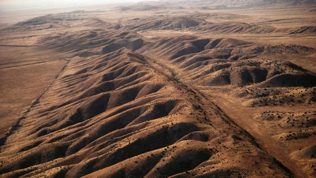
The San Andreas fault looking very obvious, but its the sneaky ‘blind’ faults which are more worrisome for LA.
Source: http://www.bbc.co.uk
The Swiss Re hazard list obviously can’t account for everything, but I find it a really interesting economic perspective on earthquake research. Science perhaps has a slight tendency to focus on ‘fashionable’ topics, and impact studies like this can help to highlight or remind us where the largest benefits may be felt by our continued efforts to understand earthquake hazards.
